Projects
Community Projects
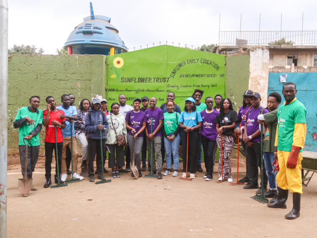
OSM KENYA WORLD CLEAN UP DAY-KIBERA SLUM
Every year, World Cleanup Day brings together millions of people across the globe with one mission – to create a cleaner, healthier, and more sustainable planet. In 2025, OSM Kenya proudly joined this global movement by organizing a cleanup activity in Kibera Slum, Nairobi – one of the largest informal settlements in Africa.
The Cleanup Activity
OSM Kenya volunteers, together with community members and local partners(Kibera Eco Care), took part in:
- Collecting litter and plastics from identified hotspots in Kibera.
- Sorting waste for recycling and proper disposal.
- Mapping cleanup points to support future waste management initiatives and inform local planners.
- This activity combined both hands-on cleanup work and geospatial data collection, underscoring how OSM Kenya uses mapping not only as a digital tool but as a driver of real-world impact.
Mapping healthcare in Kenya: HOTOSM Community Impact Microgrants
In 2020, OSM Kenya and YouthMappers Kenya received a microgrant to map health facilities in Nairobi and the surrounding counties. This was administered through a community mentorship program where a cohort of 30 were trained on all aspects of OSM. We then worked to map and enrich existing healthcare data on OpenStreetMap by leveraging open data sources ofrom the Ministry of Health and survey data by GlaxoSmithKline(2019). The project was led by Youth Mappers Kenya and OSM Kenya, and Map Kibera kindly supported the administration of the project and helped to host and coordinate its activities.
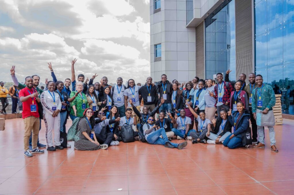
In the year 2024, OSM Kenya had an opportunity to host the global conference ‘State of the Map’ at the University of Nairobi. The conference brought together OSM enthusiasts, researchers, innovators, learners and OSM contributors from 54 countries around the world.
This opportunity has shaped the future of the OSM Kenya community as evident with the increased volunteer contribution in map data, event organization and such placing OSM Kenya as one of the most active OpenStreetMap community around the world.
Conference Highlights
- 216 participants in Nairobi + 95 online attendees
- 60 speakers
- 49 sessions: 1keynote, 35 presentations, 9workshops, 4 self-organized sessions
- 13 poster presentations
- 24 lightning talks
- 3pre-events
Satellite Imagery for social good
In 2022, OSM Kenya partnered with the Humanitarian OpenStreetMap Team (HOT) and Microsoft’s AI for Humanitarian Action to enhance mapping in key Kenyan counties. During the project period, OSM Kenya members:
- Contributed and validated 1.4 million building footprints and 19,131 km of roads in Nakuru, Turkana, and Kisumu counties.
- Utilized AI-generated and human-verified data to support city planning in Nakuru.
- Collaborated with the Nakuru City Board to identify flood-prone areas.
- Trained 20 OSM members and six county and city planning officials on AI-enabled open mapping tools.
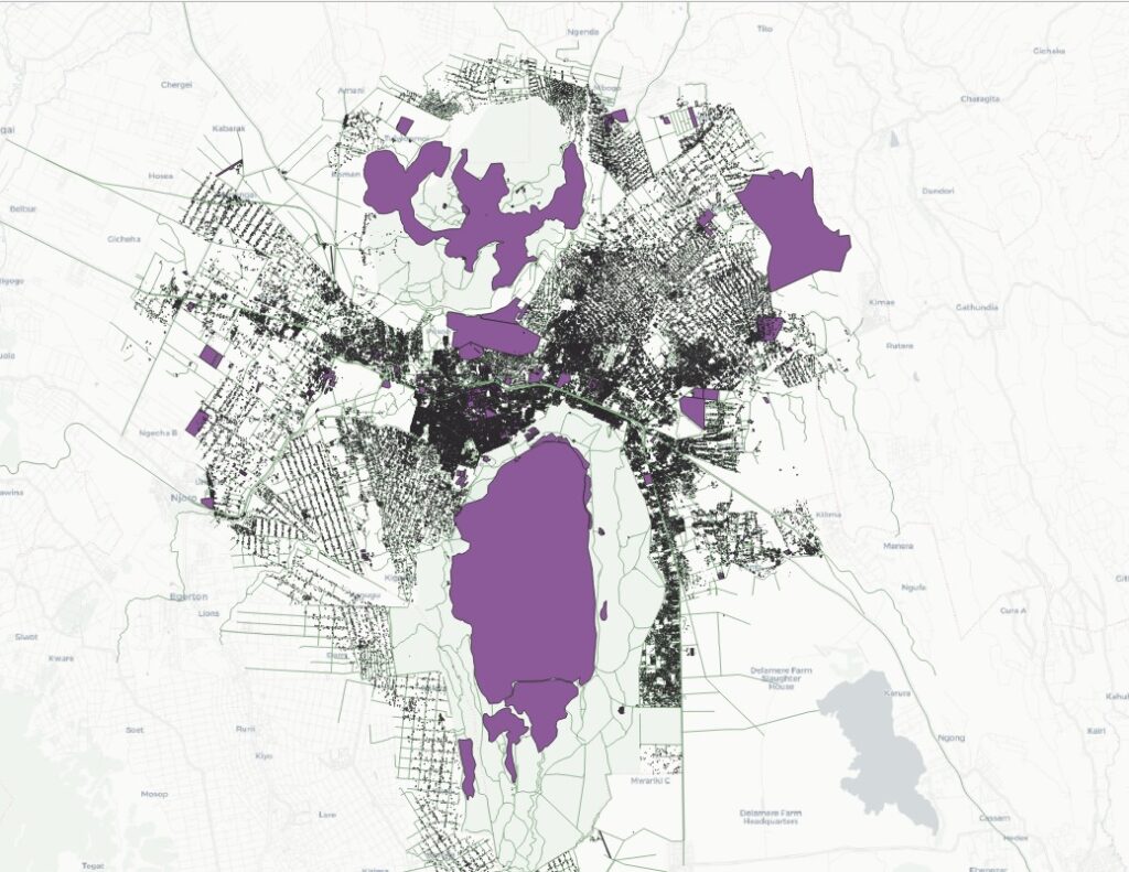
Photomapping for Sustainable Mobility using SLI in Nakuru
Enhancing Maps Through Street-Level Imagery
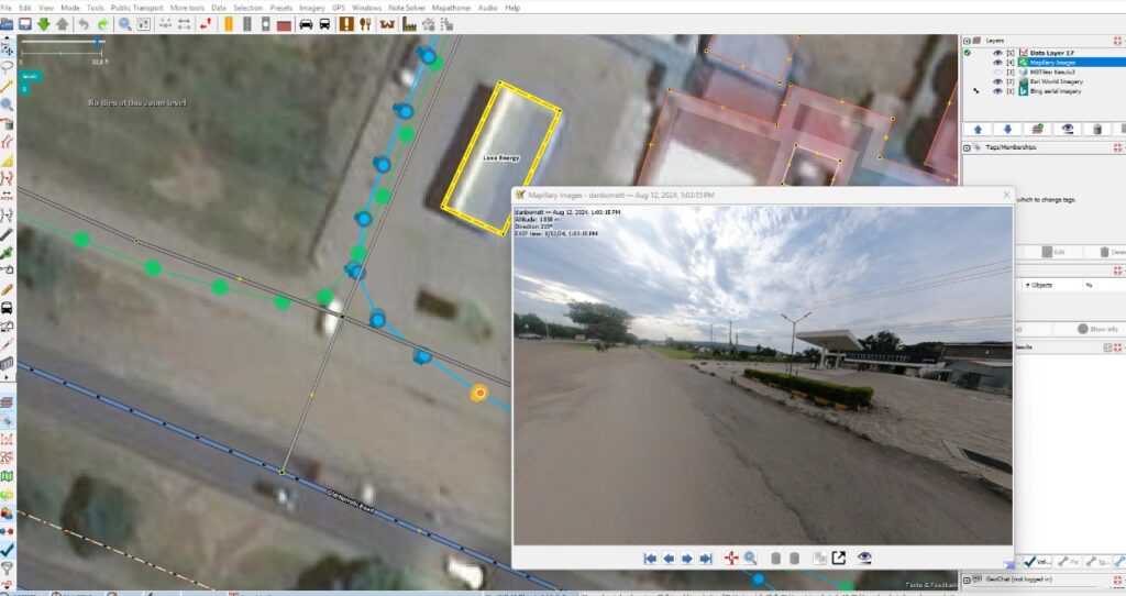
In March and April 2025, OSM Kenya collaborated with the Humanitarian OpenStreetMap Team (HOT) – Open Mapping Hub Eastern and Southern Africa on an innovative project: Photomapping for Sustainable Mobility using Street-Level Imagery (SLI) in Nakuru, Kenya.
This project aimed to advance the detail, accuracy, and usability of OpenStreetMap (OSM) data by tapping into the power of street-level imagery and AI-assisted mapping tools. By leveraging high-resolution imagery captured along the streets of Nakuru, the team worked to transform photos into valuable geospatial data that can directly support sustainable mobility initiatives.
The testing and validation of the APHRC model aimed to assess its accuracy, reliability, and applicability in addressing the intended research objectives. The process involved evaluating the model’s assumptions, testing its predictive capacity against real-world data, and ensuring that the outputs align with observed patterns. Validation was conducted through comparison with benchmark datasets, stakeholder feedback, and scenario analysis to determine the model’s robustness. The findings confirmed that the model meets the required standards for credibility and usability, providing a strong foundation for evidence-based decision-making and future applications.

Mapping Youth Friendly Services Focusing on Mental Health
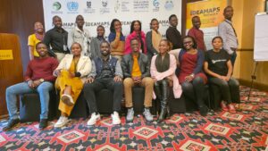
OSM Kenya continues to explore how open mapping can go beyond roads and buildings to directly impact lives and well-being. One of our recent initiatives, Mapping Youth-Friendly Services Focusing on Mental Health, aimed to highlight and map critical community resources that support young people’s mental health and overall well-being.
Celebrating International Youth Day 2025
In celebration of International Youth Day 2025, held under the theme “Youth Advancing Multilateral Cooperation Through Technology and Partnerships”, OSM Kenya is proud to launch a youth-led community mapping initiative focused on youth-friendly mental health services.
This project underscores the power of young people to drive change using open technologies and partnerships. By mapping and making visible the mental health support systems in Kenya, youth are addressing one of the most urgent and overlooked challenges of our time: mental health.